#AmangPH to bring cloudy skies, rains to Cebu

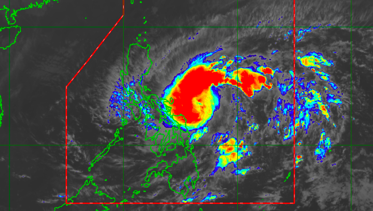
Satellite image of TD Amang as of 9:50 a.m. on Tuesday, April 11, 2023 | Photo from Pagasa
CEBU CITY, Philippines – The first major weather disturbance to enter the country may not hit Cebu but its troughs or extensions may bring damp weather, the state weather bureau said.
As of 2 a.m. on Tuesday, April 11, 2023, the low-pressure area (LPA) first spotted east of Mindanao has intensified into a tropical depression.
The tropical depression was named Amang, the Philippine Atmospheric Geophysical and Astronomical Services Administration in Mactan (Pagasa-Mactan) said.
Amang was last seen 475 kilometers east of Virac, Catanduanes. It packed wind with speeds up to 55 kilometers per hour (kph), and moving in a west-northwest direction at 20 kph.
Based on Pagasa’s forecast, they are not discounting the possibility that the tropical depression may make landfall in the Bicol Peninsula within the next 36 hours.
The same forecast also showed that Amang would not make a direct hit in Cebu.
In the meantime, Jhomer Eclarino, weather specialist at Pagasa-Mactan, said Amang may bring cloudy skies with scattered rains in Central and most Eastern Visayas regions on Tuesday.
“Magdala sad ni usahay ug kusog nga pagulan na possible ang flashfloods and landslides,” said Eclarino. (It will bring occasional rains and possible flashfloods and landslides.)
On the other hand, the state weather bureau has already raised Tropical Cyclone Wind Signals (TCWS) in several areas.
TCWS Signal No.1 is hoisted in Catanduanes, the northern portion of Eastern Samar, and the easter portion of Northern Samar.
Pagasa also issued a gale warning for the eastern seaboard of Catanduanes, northern and eastern seaboards of Northern Samar, and the eastern seaboard of Eastern Samar. This means small sea vessels are not allowed to sail.
/bmjo
RELATED STORIES:
LPA enters PH but hot, humid weather prevails in Cebu
The post #AmangPH to bring cloudy skies, rains to Cebu appeared first on Cebu Daily News.

No comments: